Plan of the Siege of York Town in Virginia
Files
Description
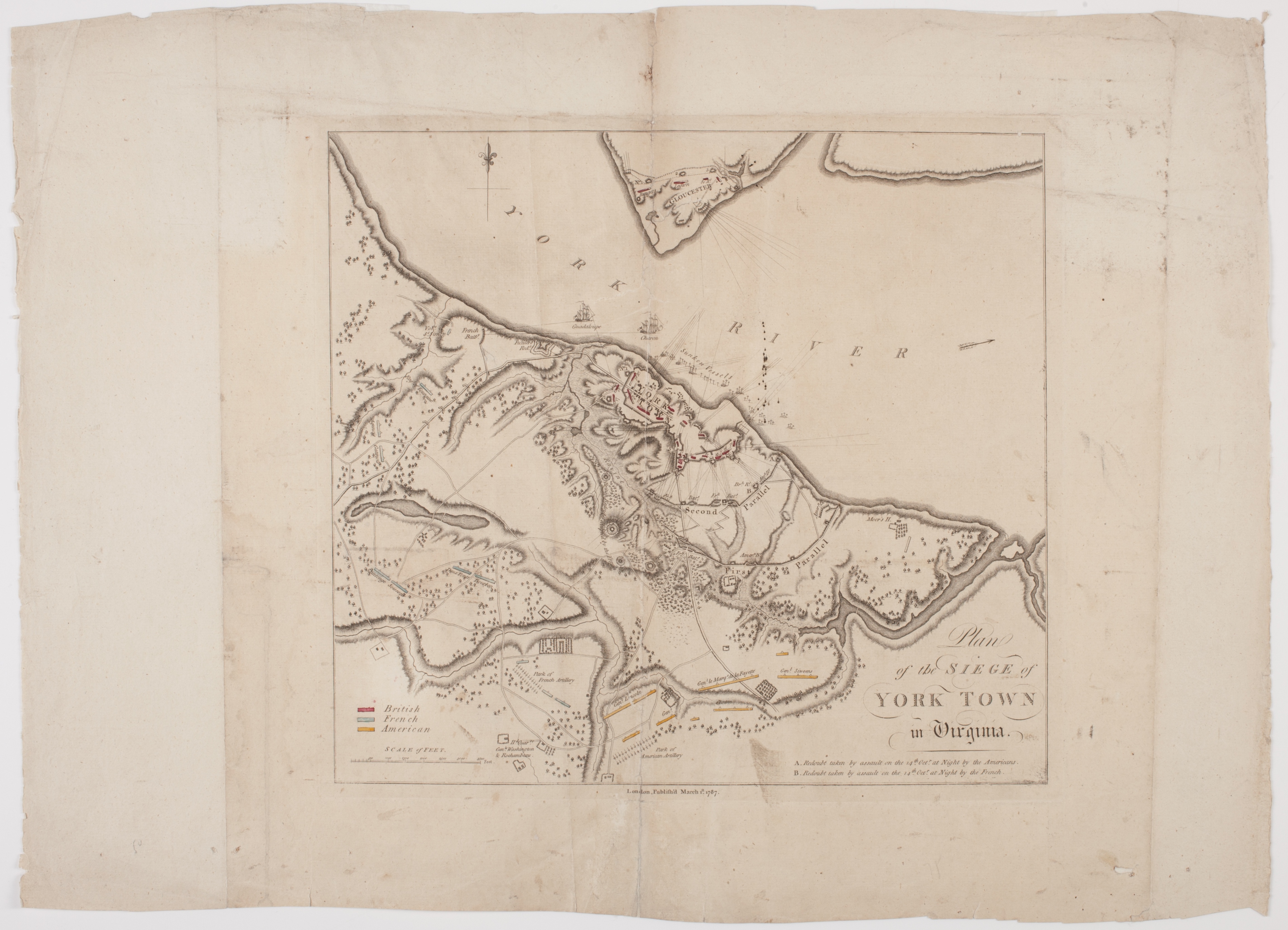
This engraved map was published in London in March 1787. It details the siege of Yorktown in 1781, the last great battle of the American Revolution. It clearly shows the American and French forces as they surround the British forces under the command of General Charles Cornwallis (1738-1805). The map also details the no. 9 and no. 10 redoubts taken by the American and French forces, which destroyed the British perimeter, allowing the Americans and French to intensify their bombardment and secure passage of the French navy, which cut off any possible water escape by the British. Cornwallis’s surrender on October 19, 1781, forced the British to negotiate for peace.
Title
Plan of the Siege of York Town in Virginia
Type
Map
Date
1787
Coverage
London, England
Format
30 x 32 cm., on sheet 42 x 56 cm.
Citation
“Plan of the Siege of York Town in Virginia,” The News Media and the Making of America, 1730-1865, accessed October 22, 2026, https://collections.americanantiquarian.org/earlyamericannewsmedia/items/show/35.